Products


In addition to student theses, final reports, and peer reviewed manuscripts, our team has developed tools or provided data for various projects to help inform aquatic conservation and management.  Below is a list of the project, the data/tool derived form that project, and a reference for the data or tool. Many of our spatial datasets and linked to a segment ID of the NHDplus stream layer.  However, we have slightly modified that layer for Missouri. Therefore, if you download the data from the projects listed with an *, please use the base layers provided immediately below. 


Conservation Planning Projects
Product Description and Link
Reference
     
Base layers for state of Missouri landscape level conservation projects Modified NHD stream network layer
Modified NHD stream catchment layer
 
     
Coordinating Aquatic Conservation Tools to Connect Priority Geographies and Guide Landscape-Level Conservation Summary of landscape level tools available for aquatic conservation planning and how to use each tool  
     
Assessing the Impact of Climate Change on Biodiversity
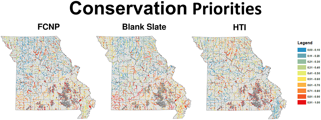
*Ranking of each stream-reach in Missouri based on aquatic conservation value within and outside existing networks Sievert et al. 2020
     
*Developing Candidate Reference Reaches for Missouri Streams Ranking of streams based on biotic index scores Paukert et al. 2020
     
Climate Change Projects
 Product Description and Link
 Reference
     
Fish and Climate Change (FiCli) Database: Informing climate change adaptation and management actions for freshwater fishes
Interactive database of projected and documented effects of climate change for inland fish Krabbenhoft et al. 2020
     
 Assessing the Impact of Climate Change on Biodiversity Composite index of potential vulnerability of Missouri fishes to changes in stream temperature, flows, and fragmentation Sievert et al. 2016
     
A Decision Support Mapper for Conservation of Stream Fish Habitats of the Northeast Climate Science Center Region Map viewer and data portal for indices classify threshold conditions in agricultural and urban land use, dam and road densities, water quality (303d impaired streams), and climate change through Northeast U.S. Daniel et al. 2017
     
Sampling Design Projects
Product Description and Link
References
     
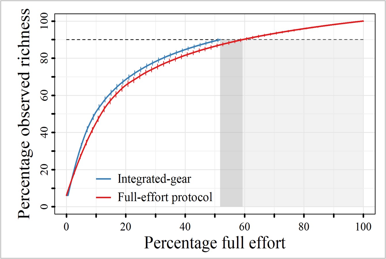
Conservation and Management of Missouri’s Mid-Sized Rivers Interactive took to determine the protocols needed to collect a user defined fish species richness Dunn and Paukert 2020